Importing DEMs and GIS data
The DEM class structure
After reading or downloading a DEM, an object of type tinerator.DEM is returned. This class contains all information related to tinning a particular GIS object: GIS data, such as the DEM matrix and shapefile polygons, meshing data, spatial data, and more. Further information on this class can be found by reading the API Documentation.
The DEM - and associated metadata - is stored in the tinerator.DEM.dem attribute, which itself is a richdem.rdarray object:
>>> print(my_dem.dem.__dict__)
{
  'metadata': {
    'PROCESSING_HISTORY':
       '\n2019-01-23 18:53:20.598492 UTC | RichDEM (Python 0.3.4) (hash="ee05922", hashdate="2018-07-13 13:01:09 -0700") | LoadGDAL(filename=data/dem.asc, no_data=-9999.0)'},
  'no_data': -9999.0,
  'projection': '',
  'geotransform': (0.0, 10.0, 0.0, 7510.0, 0.0, -10.0)
}
Upon load, this metadata is parsed into specific tinerator.DEM variables. It is unlikely an end-user will need access to this RichDEM metadata.
Reading DEMs
Reading a DEM by file
Reading a DEM via file is simply called by:
import tinerator as tin
my_dem = tin.load.from_file("data/dem.asc")
The loading function uses GDAL as the I/O driver. Supported input filetypes can be found here.
To verify import integrity, we can then plot the DEM and print metadata:
my_dem.plot_dem() # Or, tin.plot.plot_dem(my_dem)
print("NODATAVALUE: {0}\nLower-left Corner: ({1},{2})\nCell Size: {3}"
  .format(
      my_dem.no_data_value,
      my_dem.xll_corner,
      my_dem.yll_corner,
      my_dem.cell_size
  )
)
>>> NODATAVALUE: -9999.0
>>> Lower-left Corner: (0.0,0.0)
>>> Cell Size: 10.0
Each of these metadata values are mutable and can be changed as circumstances dictate.
Downloading from coordinates
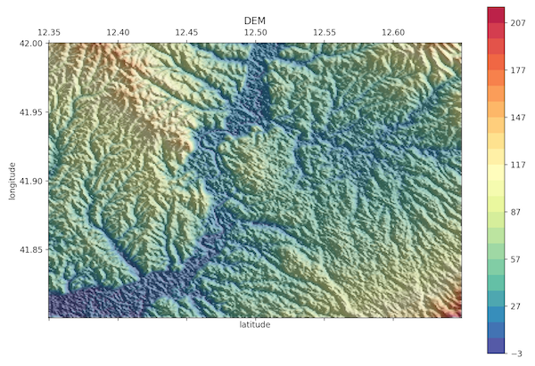
To download an SRTM 90m DEM by through a latitude / longitude bounding box,
my_dem = tin.load.from_coordinates((12.35,41.8,12.65,42),
                                    outfile='Rome-90m-DEM.tif')
where bounds is the bounding box values in geodetic coordinates (left, bottom, right, top), and outfile is an optional filepath to save the DEM.
In this example, (12.35,41.8,12.65,42) represents a subsection of Rome:
Downloading by Shapefile
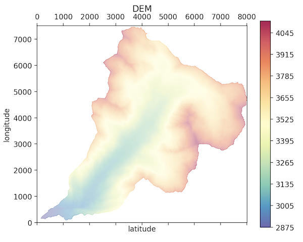
To download an SRTM 90m DEM through a Shapefile (.shp),
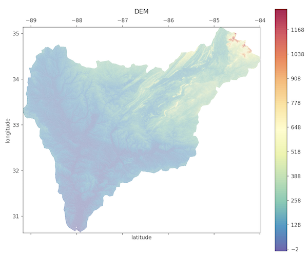
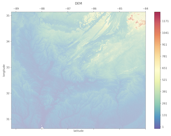
my_dem = tin.load.from_shapefile("shapefile.shp",crop=True)
The argument crop replaces all areas of the DEM not covered by the shapefile with a NoDataValue. Setting crop = False will only return a DEM bound by the spatial domain of the shapefile.
With crop = True:
With crop = False:
Applying a Shapefile
A DEM can be masked with a shapefile with the function tin.maskRasterWithShapefile. See the API for more information.