Metadata
- URI
https://anzsoil.org/def/au/domain- Creator(s)
-
Megan Wong
(mr.wong@federation.edu.au) of
Federation University
Simon J D Cox (simon.cox@csiro.au) of Commonwealth Scientific and Industrial Research Organisation
- Contributor(s)
-
Linda Gregory
(linda.gregory@csiro.au) of
Commonwealth Scientific and Industrial Research Organisation
Gerard Grealish (gerard.grealish@csiro.au) of Commonwealth Scientific and Industrial Research Organisation
Peter Wilson (peter.wilson@csiro.au) of Commonwealth Scientific and Industrial Research Organisation
- Created
- 2022-07-21
- Modified
- 2022-12-16
- Imports
-
http://anzsoil.org/def/au/asls/substrate
http://purl.org/dc/elements/1.1/
http://www.opengis.net/ont/geosparql
http://www.opengis.net/ont/sf
http://www.w3.org/ns/prov-o#
ssn:
https://linked.data.gov.au/def/project
- License
- https://creativecommons.org/publicdomain/zero/1.0/
- Source
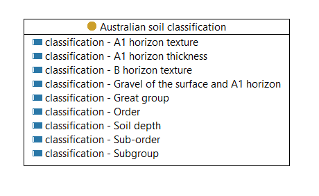
- Adapted from: Australian soil and land survey field handbook / The National Committee on Soil and Terrain Uses: Australian soil classification / R.F. Isbell (Raymond Frederick Isbell) and the National Committee on Soil and Terrain
- Ontology RDF
- RDF (turtle)
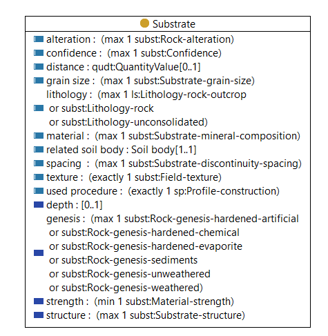
Description
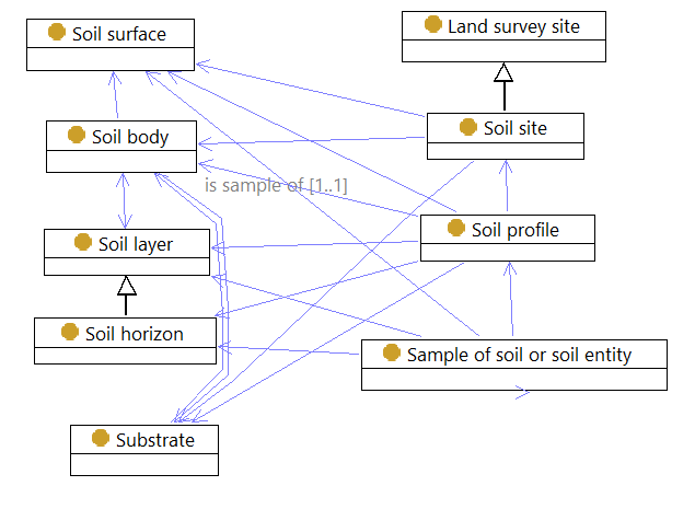
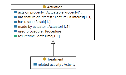
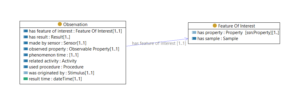
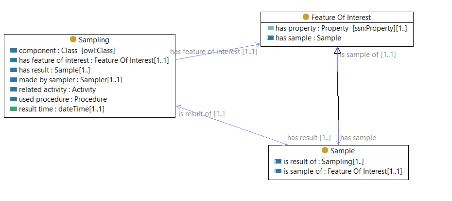
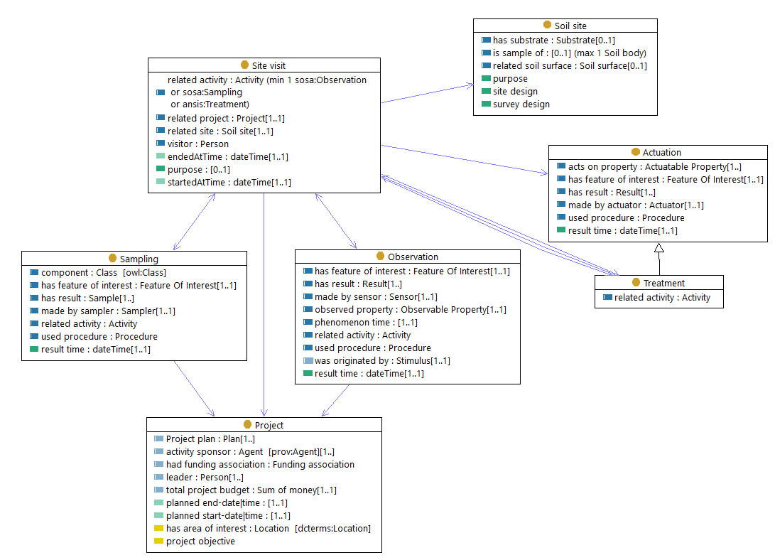
A domain-model for Australian soil data, including observations and sampling.
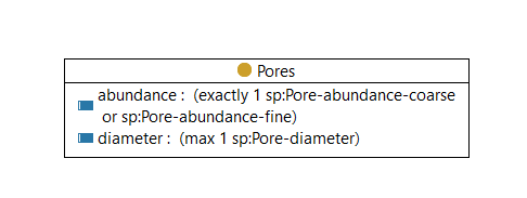
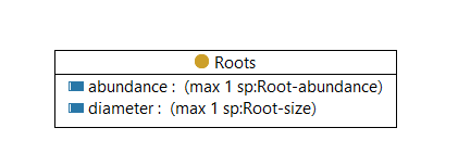
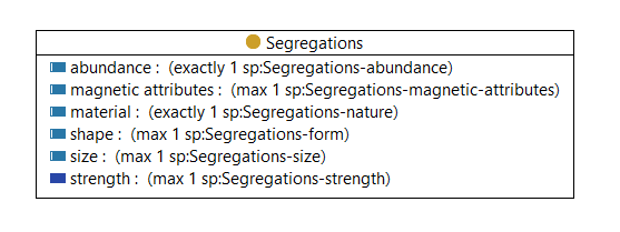
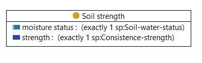
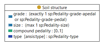
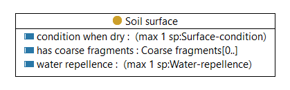
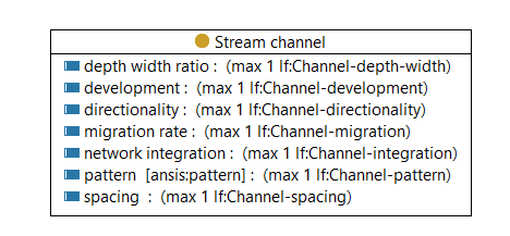
This domain model was developed in 2022 for the Australian National Soil Information System (ANSIS). It is based primarily on the elements described in the Australian Soil and Land Survey Field Handbook (ASLS). The value space of most properties are encoded as controlled vocabularies hosted, which are currently available from Research Vocabularies Australia.
The model is formalized as an OWL Ontology. Cardinalities and property value-spaces are encoded as owl:Restrictions.